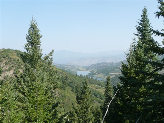
GC62FD4 Traditional Cache Rim Trail Junction
Type: Traditional | Size: Regular Regular | Difficulty: 2 out of 5 | Terrain: 2 out of 5
By: Mr, Peabody @ | Hide Date: 08/29/2015 | Status: Available
Country: United States | State: Colorado
Coordinates: N39° 13.776 W106° 56.238 | Last updated: 08/30/2019 | Fav points: 0
Dogs  Recommended for kids  Takes less than an hour  Scenic view  Parking available  Bicycles  Park and Grab  Tourist Friendly 

The Rim Trail is a popular intermediate hiking and biking trail that follows the ridge line that makes up the west edge of Brush Creek Valley where Snowmass Village sits, and goes all the way from Ziegler Reservoir in the south all the way to the Snowmass Rec Center and Rodeo grounds in the north for a total of 7.9 miles and has free busses that can take you to both ends.  The trail has great views of the town of Snowmass to the east, the whole Snowmass ski area to the south, and Wildcat reservoir to the west.  And you can see several Colorado 14ers including Capital and Snowmass peaks

View of Wildcat Reservoir

The trail is evenly broken into North Rim which is 4 miles and 600 ft elevation gain, and South Rim Trail which is 3.9 miles and 1,000 ft of elevation gain (although before the road cut was put in, you can see that it was one continuous trail).  Instead of taking the whole trail, you can start or finish at the Rim Trail juncture at the top of Sinclaire Rd where there is parking.  The North Rim Trail is closed from Dec 1st through May 16 for elk migrations and calving, but you can find the cache year round (you might have to dig if there's been a recent big snowfall).

Both summer and winter hiking/biking/horsebackriding trail maps can be downloaded at the snowmass website.

http://www.gosnowmass.com/about-us/maps-travel/snowmass-trail-maps/

 Custom URLs

Add cache to watch list
Log your visit
Picture Gallery

 Hints

North Rim next to road cut, on the ground

 Nearby Caches

GC1Y3AH Last Hope Mine (35.37 kms SE)
GC62NGP Live By Living - The Beginning (35.78 kms NE)
GC7BKAQ LILLY POND (41.29 kms SE)
GCAX935 Buford’s Backcountry Butte Bounty (49.64 kms S)
GC33EKX Colorado Spirit Quest #410 - Otto & Anna (50.94 kms S)


Driving Directions

 Logs

5 Logs: Found it 5  

Found it 04/15/2018 By Megfaires
My 2 dogs and I found it great way to get exercise and have a great time!

Found it 07/30/2017 By OurBradyBunch8
Nice little hike..beautiul view

Found it 06/17/2017 By Fruita5
In Snowmass for the weekend celebrating our 25th wedding anniversary, and decided to do some caching today! Looked in lots of places before trusting the GPS in my phone and actually following it. Cache was easily found once we were in the correct spot This looks like an awesome trail - maybe next time we're in town we can hike it. Signed log and replaced as found. Thanks for the cache!

Found it 06/02/2017 By FJ8
TY

Found it 09/17/2016 By VirginiaS
Crewing for Sky Gypsy at the Snowmass Balloon Festival.