|
GC1QY6W
 RM ORS #14-05 The Stairs
Type: Traditional | Size: Regular  | Difficulty:
  | Terrain:
  By: Team Red Rubicon @ | Hide Date: 05/02/2009 | Status: Available Country: United States | State: Colorado Coordinates: N38° 48.104 W106° 03.212 | Last updated: 08/30/2019 | Fav points: 0 


Rocky
Mountain (RM) Off Road Series (ORS) #14: Chinaman
Gulch This cache is the fifth of seven in the #14 series of Rocky Mountain off-road caches located along the difficult Chinaman Gulch Trail. The Chinaman Gulch Trail starts out just south-east of Buena Vista. This trail is somewhat challenging and should only be attempted if you have the right vehicle and some off roading experience. This trail can easily be done on foot also, so if your vehicle is not equipped, you can still do the series (a full trail description is included below).
Cache
Information RM Off Road Series #14 Compete Cache Listing 1.
Air Down
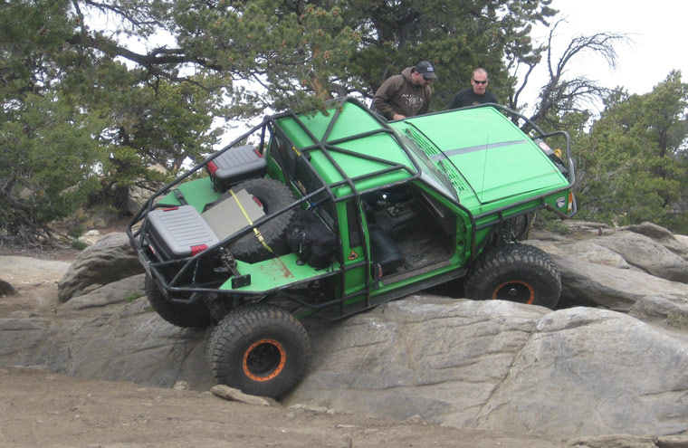
Rating/Description This trail is rated difficult and many of the obstacles do not have a bypass so you must negotiate them. It is rated a 4 (easiest routes) to 7 (most difficult routes) out of 10 on the traildamage website. Team Red Rubicon members believe that the trail should be rated more like a 6-8. Disclaimer: You need to decide for yourself if it is safe to make the trip in your vehicle and if you have any doubts, don't do it. The trail has the following named obstacles (most of the caches in this series are at the obstacles): Rock Garden - On the way to the loop.
Lots of rocks to test your flex and ground clearance. To get to the trailhead, head south on CR-301 from US 24 at N38 48.872 W106 05.970. Stay on CR-301 for approximately 1.6 miles and then go left at N38 47.507 W106 05.698. There is a gate at this point that you must open and then close behind you. You will go approximately 0.4 miles to the staging area N38 47.529 W106 05.129, passing through a second gate just before the staging area. From the staging area, you will head almost directly north on the Chinaman Gulch trail. The trailhead is at N38 47.556 W106 05.144. Note: If you head east from the staging area instead of north, you will be headed for Carnage Canyon. Unless you have an extreme rock buggy, stay away from that trail. Note: All coordinates in the above description are included on the waypoint list below. Winter
Months
Time/Distance Trail
Waypoints
Add cache to watch list Log your visit Picture Gallery
GC1QY70 RM ORS #14-06 The Chutes (0.38 kms NW) GC1QY72 RM ORS #14-07 Got View ? (0.90 kms NW) GC1QY6T RM ORS #14-04 Whales Tail (1.11 kms W) GC1QY6K RM ORS #14-03 Rock Pile (1.80 kms W) GC1R8RF The Freeway (2.02 kms W) |
Driving Directions
6 Logs:
|
 In Buena Vista for the FMCA 4 Wheelers Jeep Rally. Out on a run with several other Jeeps. Got to love these rocks. While waiting for others to clear them I had a chance to grab a smiley. Doesn't get much better than this. TFTC SL