GC8EVCJ Traditional Cache Can You Hear Me Now?
Type: Traditional | Size: Micro Micro | Difficulty: 2 out of 5 | Terrain: 5 out of 5
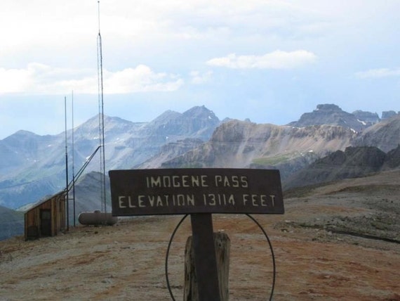
By: Pathfinder33 @ | Hide Date: 10/11/2019 | Status: Available
Country: United States | State: Colorado
Coordinates: N37° 55.914 W107° 44.163 | Last updated: 06/19/2022 | Fav points: 0
Dogs  Scenic view  Not Available during winter  Abandoned mines  Dangerous area  Not Wheelchair accessible  Parking available  Bicycles  Motorcycles  Quads  Off-road vehicles  Abandoned Structure  Short hike (less than 1km)  Seasonal Access 

Sitting on top of Imogene Pass in the San Juan mountain range sits a radio tower building. This is the location of this Soda Preform cache container.

Imogene Pass is a rugged old mining road that connected the towns of Ouray and Telluride. Access to this cache is easiest from the Telluride side (6.4 miles) via the Tomboy Mine Road, but not as scenic as the harder side form Ouray (10.3 miles) via the Camp Bird Mine Road. You will need a vehicle that has 4 wheel drive with a low range, and some decent clearance if you are coming from or going down the Ouray side. ATV/UTV can be used from the Ouray side, but not from the Telluride side as there is no parking for trailers at the trailhead in nTelluride. Neither of these towns allow ATV/UTVs to be driven in town so plan ahead if using one of those (atv/utv trailhead coords provided). This is the third highest drivable pass road in the state of Colorado. Cache sits at roughly 13,120 feet, and is a log and pencil only. Please leave the pencil in the container for those who forget a pen, or have a frozen one at the top. FTF prize would not fit in cache, so I will mail it or meet up to give once cache is found. 

Additional Waypoints

018EVCJ - ATV/UTV parking
N 38° 01.083 W 107° 40.500

P08EVCJ - Imogene Pass Parking
N 37° 55.891 W 107° 44.118

 Custom URLs

Add cache to watch list
Log your visit
Picture Gallery

 Additional Waypoints (2)

CodeNameTypeCommentsDateCoordinatesDistance
018EVCJATV/UTV parking Parking Area  01/29/2020 N 38° 01.083 W 107° 40.500 10.97 kms NE 
P08EVCJImogene Pass Parking Parking Area  10/13/2019 N 37° 55.891 W 107° 44.118 0.08 kms SE 

 Hints

Cache is not on the ground, but tucked up out of sight. You will have to get low to find it.

 Nearby Caches

GC8DV19 Fort Peabody (0.37 kms SE)
GC35X9C Shaping Up in Telluride (8.43 kms W)
GC7YX8J Alder Branch (98.88 kms E)
GC5DGNZ BEYOND Grand Veiw Cairn (123.88 kms N)
GC5ENFA Split-rock cairn (123.94 kms N)


Driving Directions

 Logs

1 Logs: Publish Listing 1  

Publish Listing 10/13/2019 By IgnotusPeverell
Published