 06/29/2018 By PictureLiberty
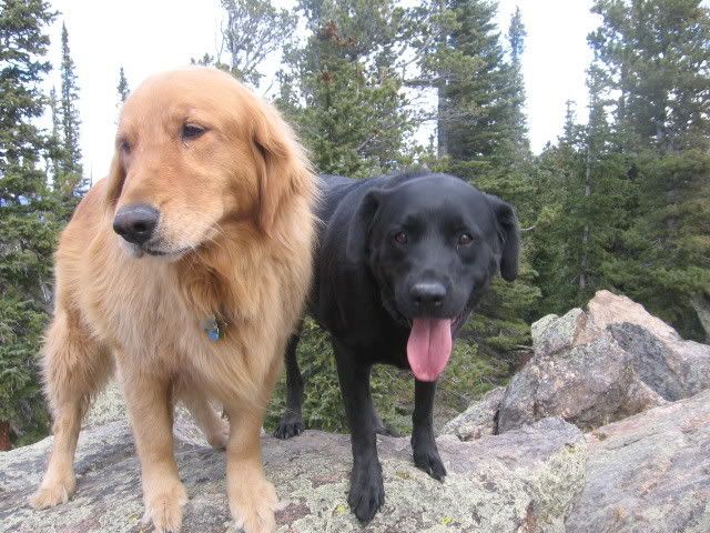
A very unique find to be sure. A difficult hike by most people’s standards - exquisite flower displays the entire traverse and wonderful friends to explore and adventure with. Thank you KingJR, Team Laxson and Takes the Hard Way for encouraging us to make it to the top! Thank you Zoltig for an awesome excuse to hike a challenging trail! As Team Laxsom mentioned, it was special to find you waiting for us at our campsite when we returned already warming the coals for our ‘recovery supper’! TFTC!
 Photo
Photo
06/23/2018 By Takes the Hard Way
I was the last one to the top....now I'm the last one to log the cache!
Team Laxson and I attempted to get to the top of West White Pine about a year ago. We only made it about a mile up the trail that day before we turned around and made our way back down. Since then, it has been my goal to get to the top of that mountain. I spent many hours on the treadmill and hiked many miles in order to get myself ready for the hike today. I was in better shape than last year but it was still a very tough hike. I remember at one point thinking....this is the hill that never ends. Just when I thought there might be a flat section, I would go around a corner...only to find another hill. There were a few times where I was ready to give up....but I was so close....I had to keep going...and it paid off. Thanks Team Laxson, KingJR and Picture Liberty for sticking with me and giving me the motivation to make it to the top! It was a great day with great friends! Oh and the cache at the top was an added bonus!
SL Took Memories Left a completed goal!
06/23/2018 By Team Laxson
8 Years. This cache has been un-found for almost 8 years. It has survived a massive fire. It has survived a 1,000 year flood. It has survived the road closure. My how things have changed.
KingJr, Takes the Hard Way, & PictureLiberty took the very long 3 mile hike to look for this cache. With the road closure, windfall has made the trail very difficult and exhausting to traverse, with many trees to step over, and steep sections of rock that, after reaching the summit, you have to navigate down. Do not take this hike lightly - it will take more time than you think, you will need more water than you think. That being said, this day was a great day. We camped along 44h last night and made the quick 20-ish minute drive to the trailhead. Spent the day on the trail with friend, with the goal to find another friends cache.
After finding the cache, navigating that nasty terrain back to the Jeep, then navigating back to camp, we were greeted by zoltig at our camp, prepping our dinner fire. I gotta say, that was pretty awesome timing!
(3041)
06/23/2018 By KingJR
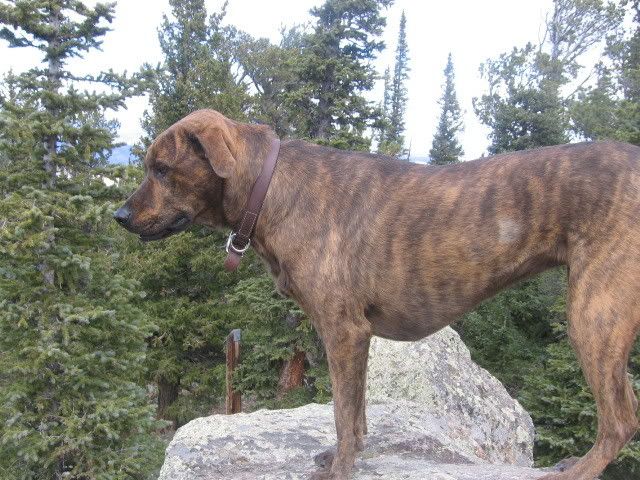
WHAT A HIKE! This cache had been on my list of "to-do" items for years and years. Then the high park fire closed this road, and the flooding rains of 2013 washed it away.
The road may be closed for now, but you can hike it! The flowers were amazing, the views from the top worth it. And to be the first person in essentially 8 years to find this (I summit first from the group I was with) was a special treat.
The cache is still there, survived the fire tucked away in its hiding spot. And it's totally dry!
Great day with great friends!
KingJR
Photo
 12/17/2015 By sarahjanel
Going to be in the area and noticed this cache. Can the owner verify the cache is still there since it has not been found since 2010? I hate to waste my time if it is not.
10/07/2010 By COpackrat
Too bad the lookout is gone, it would be fun to climb up there and get scared... :-) TFTC
06/29/2010 By Denali41
This time, my puppy Teewinot and I made it to the cache location! See my note below, indicating we got mired down in deep, collapsing snow the first time we tried for it. After a good search, I reeled the cache in and signed a fairly wet log. I dried it in the sun for a while, but eventually needed to leave due to threatening thunderstorm clouds. Also dried the interior of the container and made certain the lid was snapped on tightly before I re-hid it. This was the second time I've been to the summit of West White Pine Mountain. In summer 2007, soon before this cache was placed there, Carolyn (Denali Queen) and I went up there with my puppy Teewinot as we were well along on our quest to climb all 255 of the ranked peaks of Larimer County We enjoyed fine weather up there, before heading over to East White Pine Mountain and then down to where we had parked along the Buckhorn Canyon Road. I dedicated my "find" in the cache log in loving memory of Carolyn, who had been my climbing partner all around the world for several years before her death 2 years ago while she was descending from the summit of the Matterhorn, in Switzerland. In a real sense, Denali Queen was with me yesterday as we scooped in that cache together. For those of you looking for a couple of serious caching adventures, go after Carolyn's Cache (GCHAAF), a 5-star-by-5-star beauty, as she was. Or try Mull of Crosier, another challenging cache dedicated to her memory.
Thanks for 'To Mistaken Crab'. It met my expectations.
05/19/2010 By Denali41
Well, my puppy Teewinot and I tried to "push" Spring a bit too much, taking the hike up West Pine Mountain to locate the cache. Lots of snow, even on the south-facing slopes. Beginning at about 9,600 feet of elevation (700 feet below the cache location), snow became deep, deep, deep. We finally turned back, realizing that the cache would be deeply buried. So we'll take another trip up here some time. Denali Queen, my puppy Teewinot, and I already hiked up both summits of White Pine Mountain, but that was before this cache was placed! It's a nice hike, so I won't mind doing it again.
09/10/2009 By pickupthepace
Great Cache! H.Abode and I hung out at the top of the hill for awhile enjoying the views. Thanks for bringing us up here. SL.
09/10/2009 By H.Abode
Out on a two day adventure with pickupthepace. Fun relatively easy 4x4 road. Got to the site and wahoo, gorgeous! TFTCSL
 'To mistaken crab.'
 | Difficulty:
  | Terrain:

;)
;)