05/03/2018 By Rev Mike
Lots of snow and the approach from the south was closed.
Now that I'm home and looking closer at the map it looks like there is another approach to the north.
I guess maybe next time but I need to visit CO later than May sometime so more of the Jeep trails are open.
- Rev Mike
 09/13/2015 By loverfishy
Very cool hike back here! We passed quite a few mountain bikers on other trails on the way in- love to come back to this area when I have a bit more time. Great day for caching and adventuring. Will post a few photos soon. TFTC! :)
06/27/2015 By fasted23
found
06/27/2015 By Sapper489
FUN CACHE, I believe we approached this from the opposite way intended, we did have fun and log a find. TFTC Sapper489
06/13/2015 By starnsun
Wheelin' in the area today and stopped by and took in the sights. TFTC
 10/15/2014 By Team Red Rubicon
4x4 11-Champion Mill was transferred from n0wae to user Team Red Rubicon
09/27/2014 By meryleea
Our friends are the property owners. Great first find and easy hike from party headquarters.
09/05/2012 By davjam
 Our second find! Good one.. Fun 4 wheelin' . Need a decent 4wd for this one. Be advised that FS road 105 is closed where it returns to to hwy119 (Magnolia) until spring (forest service is doing mitigation in the area). If you do this one, you'll need to backtrack to Rollinsville to get out.
davjam
08/23/2012 By tiki_iria
 TFTC went with Mapachoo. The sunglasses are still there and oddly clean looking as well. Awesome location. It is too bad it is not being preserved though.
08/23/2012 By MaPaChoo
Wow over a year since the last log we have been wanting to get this one for a while.Thanks for the Cache visited with TikiIria and her little one "BrenBot" and Tiki"s sister was along for the hike as well. Took the Towmater truck for Brenon and left our signature path tag. Oh By the way the sunglasses are still there on the stump next to the cache.
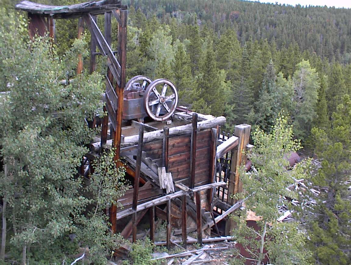
 4x4 11-Champion Mill
 | Difficulty:
  | Terrain:


 Big boy!