|
GC6VW3K
 Lake Pueblo Sedimentation
Type: Earth | Size: Other  | Difficulty:
  | Terrain:
 By: msstrong @ | Hide Date: 10/20/2016 | Status: Available Country: United States | State: Colorado Coordinates: N38° 14.900 W104° 44.173 | Last updated: 08/30/2019 | Fav points: 0 


")

This is a beautiful over look of Lake Pueblo, including the dam, marina and camping area. This EarthCache can be accessed from inside the park, this is a fee area. You can get more information about all the trails around Lake Pueblo at this web site: http://www.lakepueblotrails.org/ The trail head and Parking are at this location, N38 15.077 W104 44.154 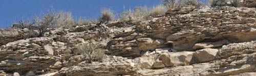 ??????Lake Pueblo Park has a rich geologic history. The rock layers visible throughout the park reflect a number of interesting geological processes. According to Brad Sageman of Northwestern University three of the most important processes are the following: 1.DEPOSITION OF SEDIMENTARY ROCKS. During the Cretaceous Period a vast inland sea connected the Arctic region with the Gulf of Mexico and a massive mountain range bordered this sea on the west (present day Nevada). The shallow sea extended from Utah to Kansas and covered the area that is now Lake Pueblo Park. Sediments shed from the western mountains accumulated in the broad basin and preserved numerous plant and animal fossils. As these layers were buried deeper in the basin and compacted they turned into rock layers of sandstone, shale, and limestone. 2.UPLIFT AND MOUNTAIN BUILDING. Toward the end of the Cretaceous, the uplift of the present Rocky Mountains began. This uplift created the impressive ranges seen to the west of Lake Pueblo, and it also elevated the high plains east of the Front Range. The geologic period following the Cretaceous is called the Tertiary, and it witnessed the deposition of non-marine sediments on the high plains, shed from the uplifting Rocky Mountains. 3.EROSION AND LANDSCAPE EVOLUTION. As the Tertiary progressed, the river systems seen to this day were developed, draining the uplifted mountains and eroding the high plains. One of these rivers, the Arkansas, carved out the valley now filled by Lake Pueblo. This erosion created the steep bluffs on the north and south sides of the lake, and these bluffs just happen to be one of the best exposures of sedimentary rocks deposited during the Cretaceous found anywhere in the world. Geologists give names to rock layers that can be traced over large areas. The layers visible in Lake Pueblo Park include, in ascending order, the Dakota Sandstone, Graneros Shale, Lincoln Limestone, Hartland Shale, Bridge Creek Limestone, Fairport Chalky Shale, Blue Hill Shale, Codell Sandstone, and Ft. Hayes Limestone. These rock units can be seen along the dam spillway, through Rock Canyon and up into the Liberty Point area on the North side of the dam. Geologists also define geologic time by designating specific locations that serve as the standards for all other rocks of the same geologic age. Because Lake Pueblo's Rock Canyon area has one of the best exposures, fossil records, and other characteristics it was chosen as a GSSP (Global Boundary Stratotype Section and Point)https://en.wikipedia.org/wiki/Global_Boundary_Stratotype_Section_and_Point(information about this marker can be found here) By Peter Neaum at English Wikipedia, CC BY-SA 3.0, Link - an internationally agreed upon stratigraphic section which serves as the reference for a particular boundary on the geologic time scale. Geologists from around the world travel to Lake Pueblo to study this site. Fossils are quite common on the park, but please remember that collection of rocks or fossils is prohibited. The information above was taken from http://cpw.state.co.us/placestogo/parks/LakePueblo/Pages/Geology.aspx 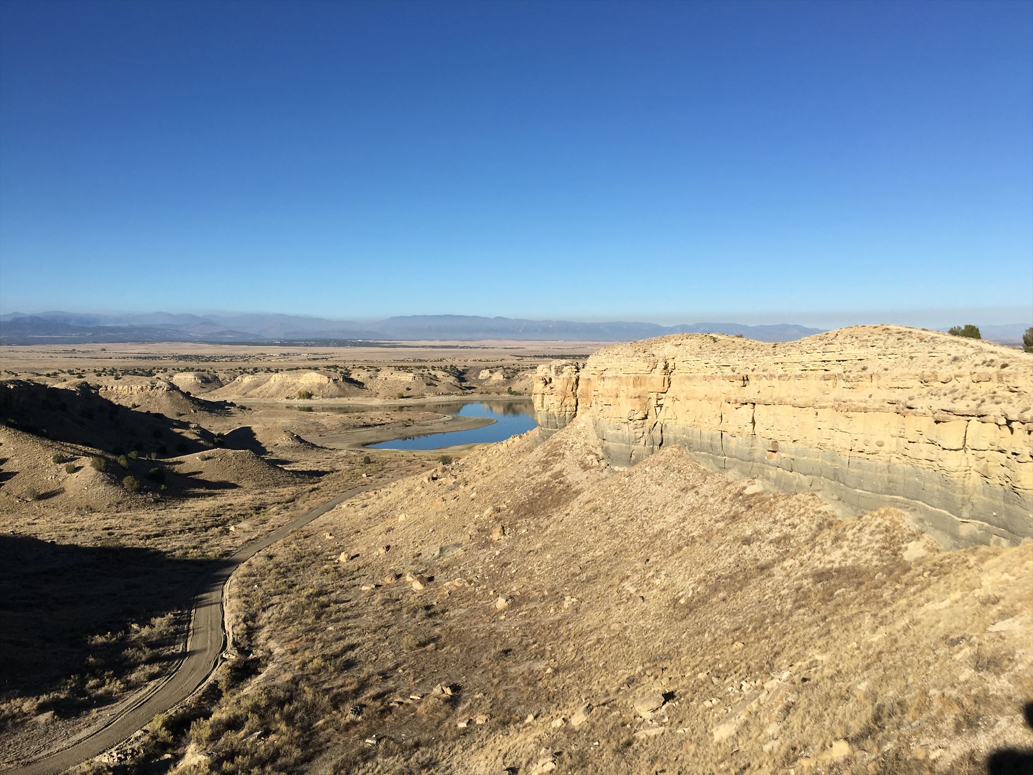 This is the bluff that the trail is on. PLEASE BE VERY CAREFUL BECAUSE THERE ARE HIGH CLIFFS, STAY AWAY FROM THE EDGES. 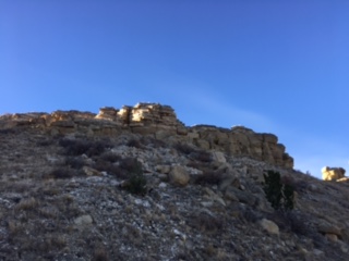 PLEASE BE CAREFUL AT THIS LOCATION!! DO NOT ATTEMPT TO CLIMB DOWN ANY OF THE EDGES!! You will notice this portion of the Butte is Calving or eroding due to soil erosion. To get credit for this EarchCache please answer the following questions: 1. How wide is the chasm or how much has it separated from its original location due to the erosion? 2. What erosional forces have caused this much erosion at this particular location? 3. What kind of soil is at this location? Photos are not a requirement to log this EarthCache but they do a great job of showing the history of this location over time, PLESAE NO NOT show to much of the chasm in your photos so as to not give away any of the answers. Additional Waypoints OP6VW3K - Optional parking and trail headN 38° 14.219 W 104° 43.791 PK6VW3K - Parking & Trail Head N 38° 15.077 W 104° 44.154
Add cache to watch list Log your visit Picture Gallery
GC5F6Q1 By trail or road??? (47.11 kms NW) GC5F6QV Bear tracks by moon light (50.64 kms NW) GC6VRRW Dakota Ridge # 3 (51.47 kms NW) GC5F6QG The trees need care too (59.01 kms NW) GCYZDZ Dug Out Cache (62.39 kms NW) |
Driving Directions
8 Logs:
|