GC8Z7BF Traditional Cache Just Because!
Type: Traditional | Size: Micro Micro | Difficulty: 3 out of 5 | Terrain: 4 out of 5
By: RPieperCO @ | Hide Date: 08/30/2020 | Status: Available
Country: United States | State: Colorado
Coordinates: N38° 57.725 W104° 54.188 | Last updated: 06/19/2022 | Fav points: 0
Scenic view  Significant hike  Not Available during winter  Cliff / falling rocks  Dangerous area  Thorns  Medium hike (1km-10km) 

This cache was placed at a neat well shaded spot while CVA64 and I were returning from another hike in the area.  It was only a few days after we last hiked up in this area that another couple of cachers placed a few more caches!  Ha ha ha!  Some cachers are mean!  So this is a sort of return the favor kind of hide!


The hike starts off easy enough, then the trail gets smaller and smaller with only a few cairns to guide you then nothing at all.  You will head through a lot of scree, rock scrambling, and steep slopes to get to this and others in the area.  There is such a varied terrain of nice forest, burn scared trees, lush under growth, bald hot exposed scree, etc..  Plan accordingly for extreme heat and even extreme cold or rain.  You may even take into consideration of the wild life.  We found mountain lion scat and bear scat in this valley.


You will find an obvious location at the GZ, search around it.  It's a micro but it should be obvious to spot it's hiding place.  Please hide back as found.

Additional Waypoints

P08Z7BF - Blodgett Open Space Parking
N 38° 56.932 W 104° 53.158

T08Z7BF - First turn off of main trail
N 38° 57.204 W 104° 53.803

T18Z7BF - Turn here, follow cairns and sparce trail
N 38° 57.577 W 104° 53.791

 Custom URLs

Add cache to watch list
Log your visit
Picture Gallery

 Additional Waypoints (3)

CodeNameTypeCommentsDateCoordinatesDistance
P08Z7BFBlodgett Open Space Parking Parking Area  08/30/2020 N 38° 56.932 W 104° 53.158 2.09 kms SE 
T08Z7BFFirst turn off of main trail Trailhead  08/30/2020 N 38° 57.204 W 104° 53.803 1.11 kms SE 
T18Z7BFTurn here, follow cairns and sparce trail Trailhead  08/30/2020 N 38° 57.577 W 104° 53.791 0.63 kms SE 

 Nearby Caches

GCADKG1 Anaya - Spider Girl - MMCU Cache (10.05 kms NE)
GC8Z7CM Rocky Beaver (11.81 kms NW)
GCAX9P9 Sasquatch lair (17.03 kms NW)
GC1Y04G Union Printers Home Cache (17.61 kms SE)
GC6R75W The Flash Mob Cache (18.55 kms SE)


Driving Directions

 Logs

4 Logs: Found it 3  Publish Listing 1  

Found it 09/14/2020 By gampa&gamma
The weather was forecast to be cool and clear this morning - perfect for going after this cache. We were on the trail just before sunrise. The climb up to the cache from the “cairn trail” was tough - we chose to climb the scree hill rather than up the valley to avoid the deadfall and scrub oak - not sure if that was the easier path or not. But we made it to GZ and quickly found the cache. We considered hiding another cache up on the ridge but we’re not mean cachers! The CO must have been referring to that other cacher who hid a cache on that ridge!
Anyway, we had a great hike on a beautiful morning. Thanks for bringing us back up here (but please don’t bring us back up here again!)

Found it 09/04/2020 By CVA64
I was with RPieperCO on placement of this cache the day we headed way up the ridge for two caches placed just after the last time we were here. Two guys sucking wind up the ridge face but we're successful.

He forgot to mention though Big Foot was seen in the area seeking shelter immediately per the USAFA loudspeaker directions because lightning was seen within 5NM. We didn't care about the weather and enjoyed the hike nonetheless. You all come get this one too and enjoy the adventure!

Found it 09/04/2020 By MountainBear
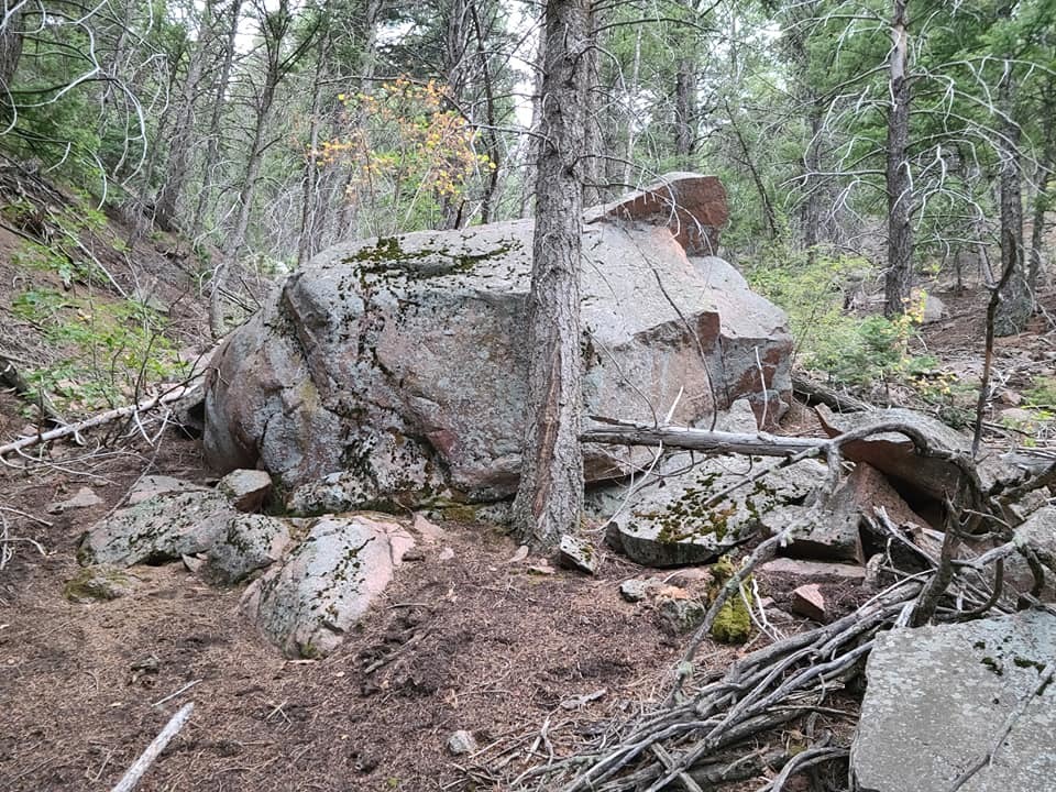
FTF at 2:54. Great way to start the Labor Day weekend! We picked an early ridge to climb, and we kept hoping there would be a better way down. Then we realized that we went too high and had to scree down to the cache. Great hide. Seeing the picture on the cache page was helpful. TFTC!

Publish Listing 08/30/2020 By IgnotusPeverell
Published